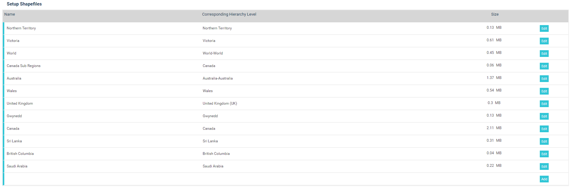
Go to Administration > GIS Administration > Setup Shapefiles.
Following options will be displayed: You can either update an existing shapefile or create a new shapefile.
To update an existing Shapefile:
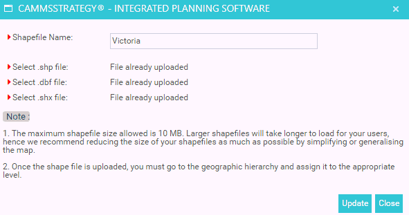
Select 'Edit' button for the particular shapefile and edit 'Shapefile Name'. Click Update. Uploaded files types will be displayed underneath.
To add a New Shapefile:
Click on 'Add' button. Following popup will appear:
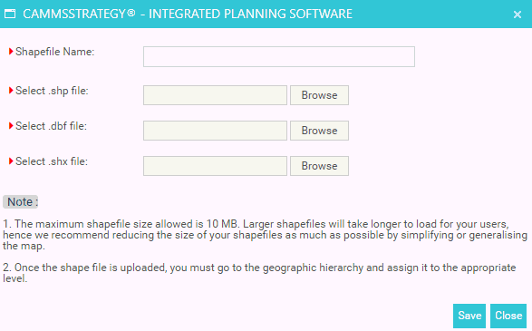
Shapefile Name: Type a name for new shapefile.
Select .shp file: Click on Browse button and navigate to Shapefile location to upload.
Select .dbf file: Click on Browse button and navigate to Database File location to upload.
Select .shx file: Click on Browse button and navigate to AudoCAD compile shapefile location to upload.
| The maximum shapefile size allowed is 10 MB. Larger shapefiles will take longer to load for your users, hence we recommend reducing the size of your shapefiles as much as possible by simplifying or generalising the map. Once the shape file is uploaded, you must go to the geographic hierarchy and assign it to the appropriate level. |
Copyright © 2014-2015 CAMMS Online Help. All rights reserved.
Last revised: November 26, 2017